Petrified Forest National Park and the Painted Desert

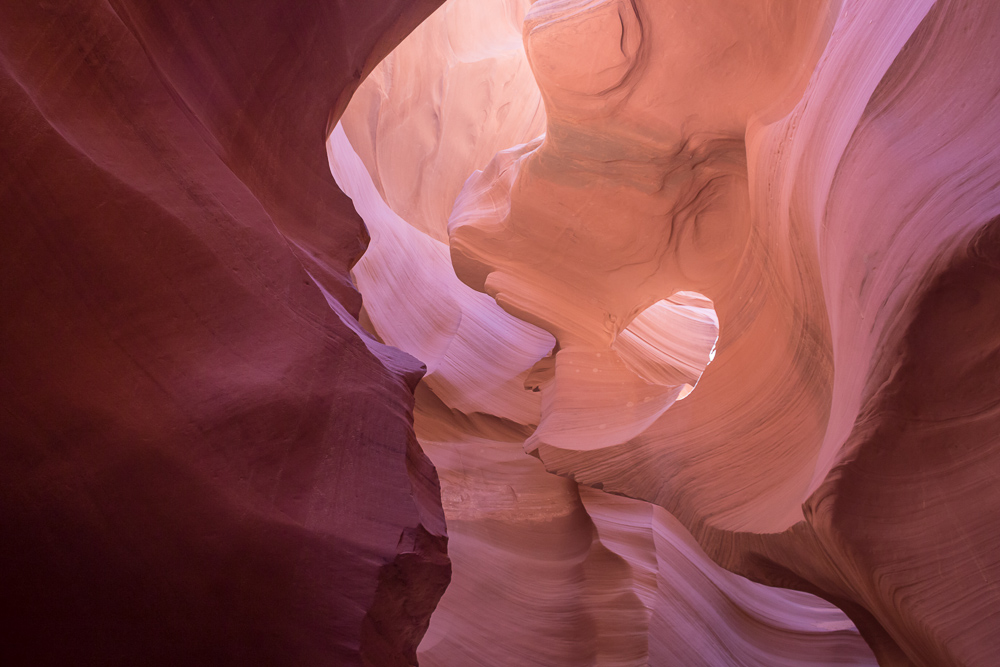
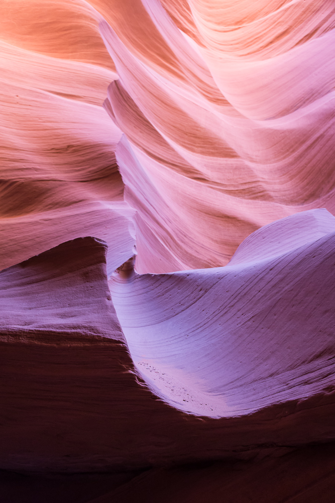
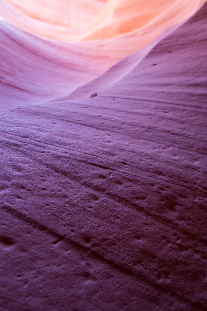
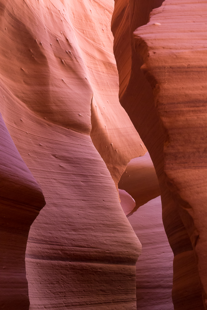
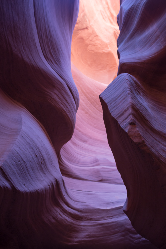
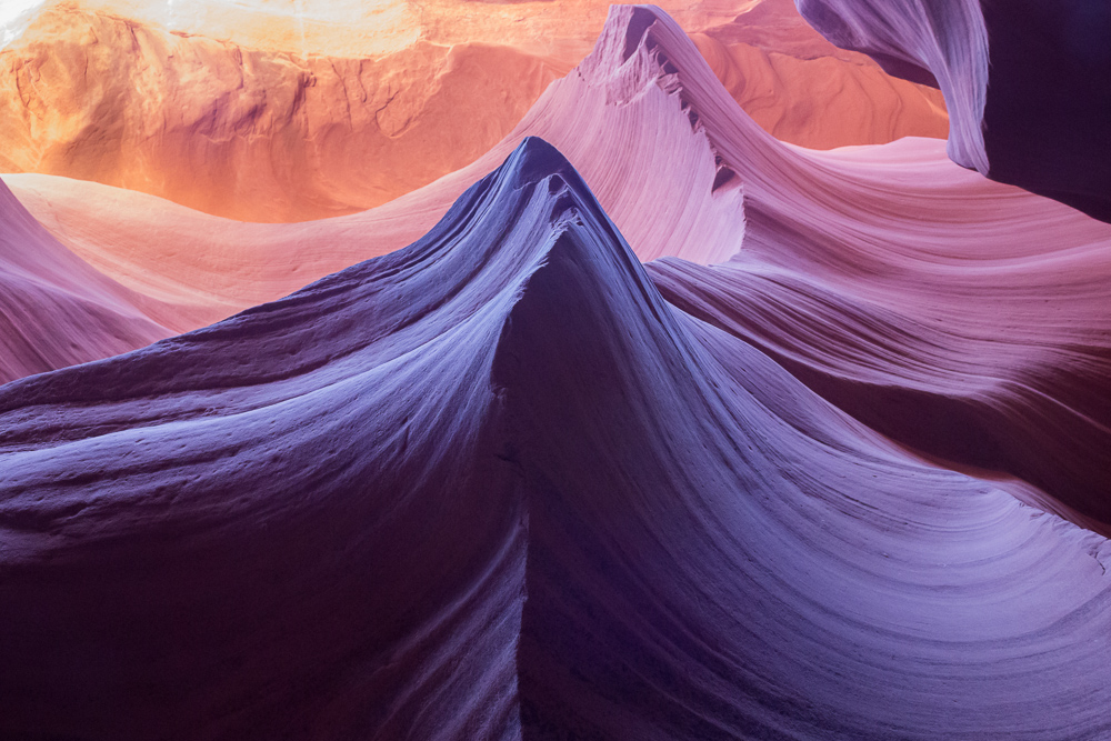
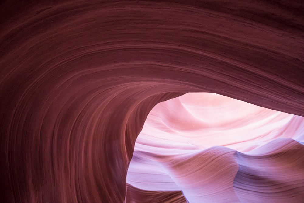
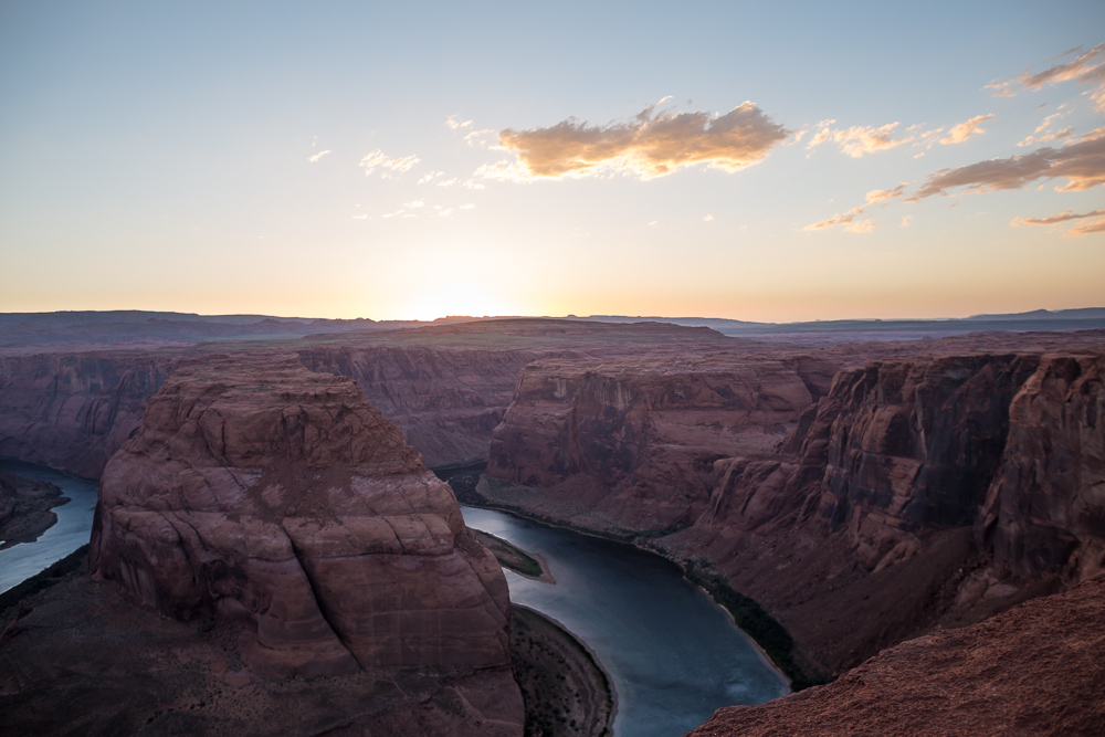
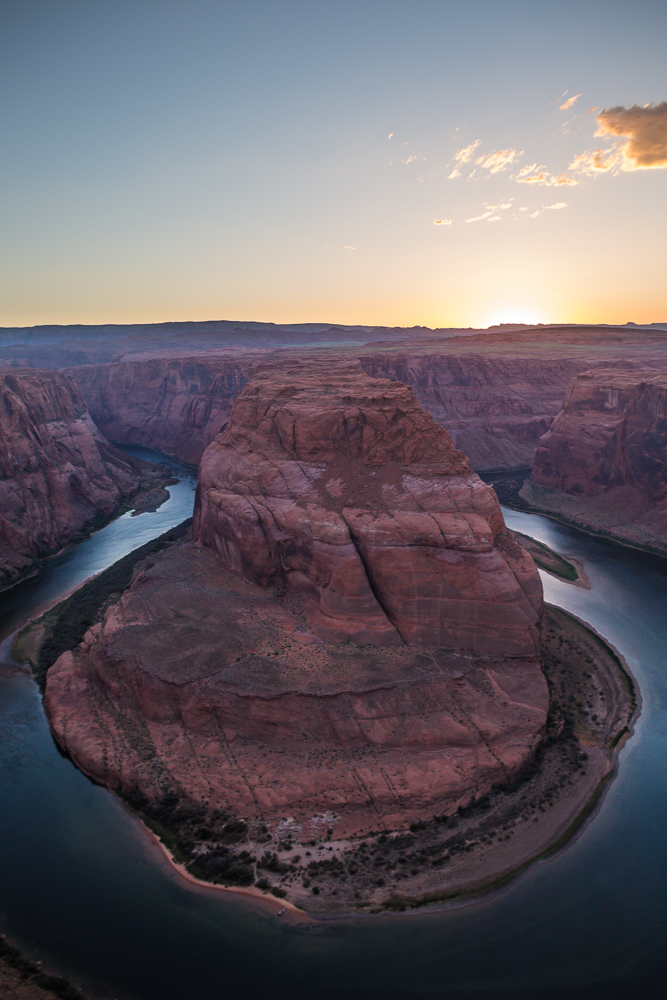
Visiting the Painted Desert and the Petrified Forest National Park was one of the most profoundly beautiful experiences of my life, and especially so because I didn’t have big expectations for the park.  Lower Antelope Canyon was amazing, but I had seen many pictures before, so I expected it to be amazing.  I didn’t have any for the Petrified Forest or Painted Desert.

This was despite what I’d heard growing up at home – my Dad talked about the place a lot.  He had gone on a trip in the Southwest with coworkers more than 20 years ago.. but he went to Arches National Park.  I remember that he purchased the VHS tape from the gift shop and had us watch it a few times after he got back.  Over the years, he talked about the Petrified Forest it enough that somehow I got the impression that he’d been there before.  But it wasn’t until we went on the trip that I found out that he had never been.

It was mid-afternoon when we arrived, and it was still hot.  Like in the mid-90s maybe.  But luckily, it was also pretty breezy, which made the heat more tolerable.

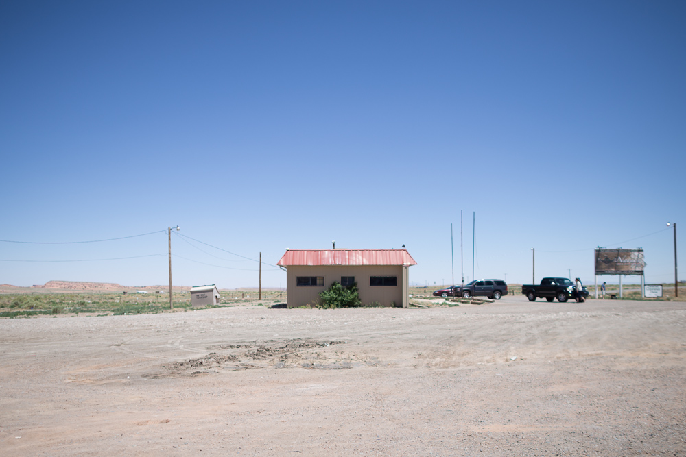
We pulled up to a fairly empty visitors center.  We learned that the painted desert was named by an expedition of Spanish explorers who called it “El Desierto Pintado.”

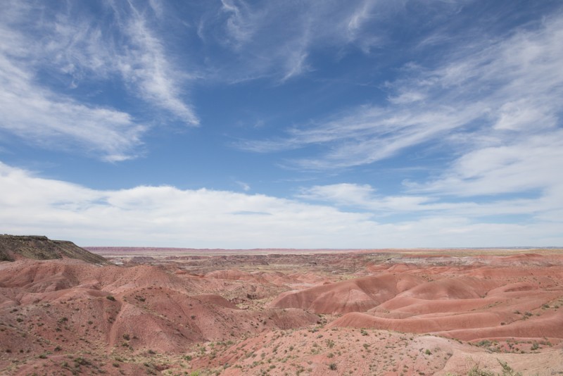
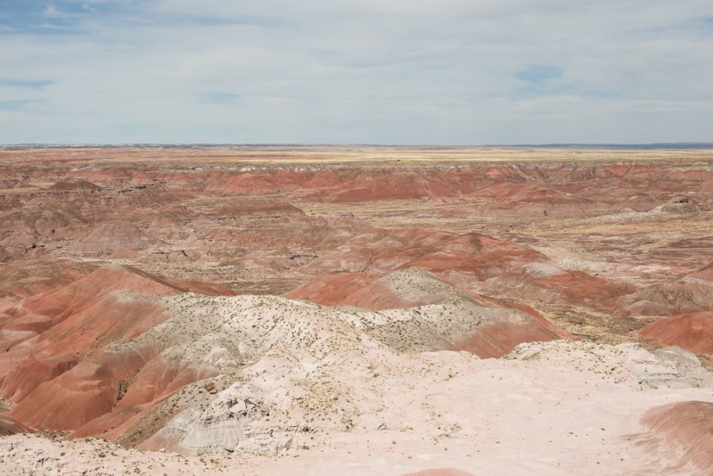
One could see for miles and miles, and the hills were full of different colors.  We picked up a map from the NPS and started driving to the different scenic viewpoints.  You enter along Route 66, and can drive about 25 miles south through the park along the designated road.  We stopped for views at Kachina and Chinde point.

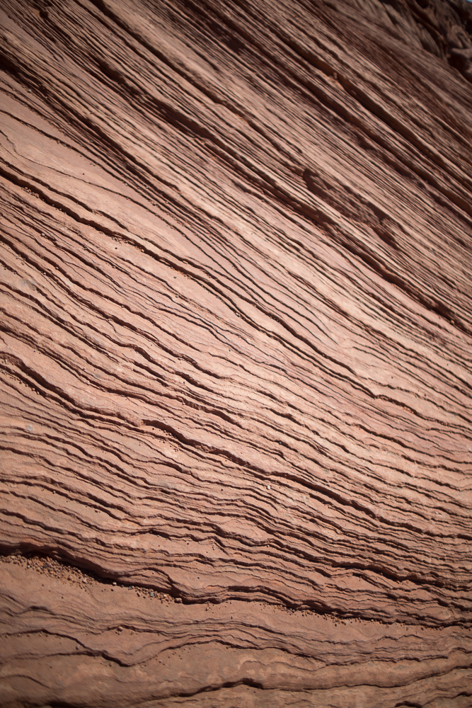
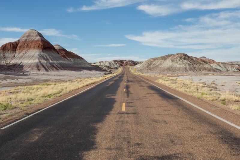
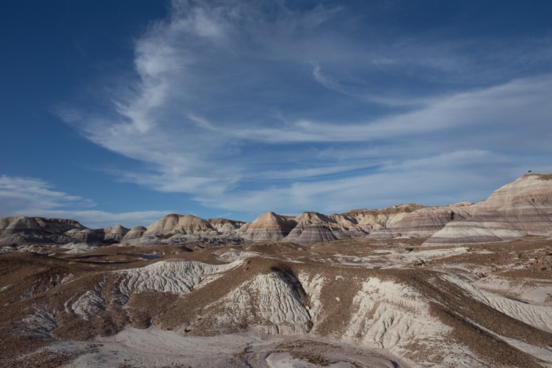
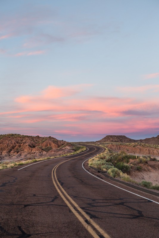
There’s a cool part of the park where you drive over Route 66 as you head south.  The landscape changes over a bit, revealing striated badlands with some pretty amazing topography that stands in stark contrast to the blue sky.

IMG_2865m

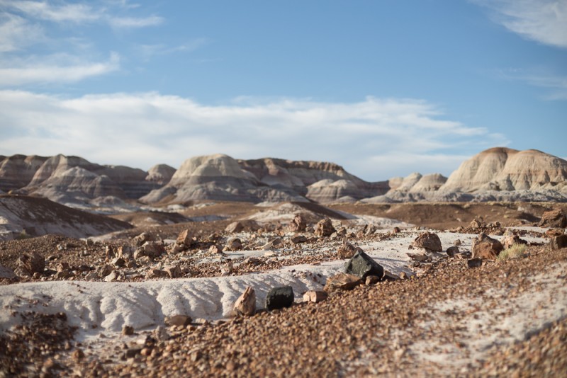
There is a short, paved and gravel hiking loop around the Blue Mesa area, where the hills are covered with a “bluish bentonite clay”.  Walking around there felt particularly … lunar to me.  There were only 2-4 other people in the entire area other than my dad and myself, which made it even easier to imagine that you were on the surface of a different world.

IMG_2882m

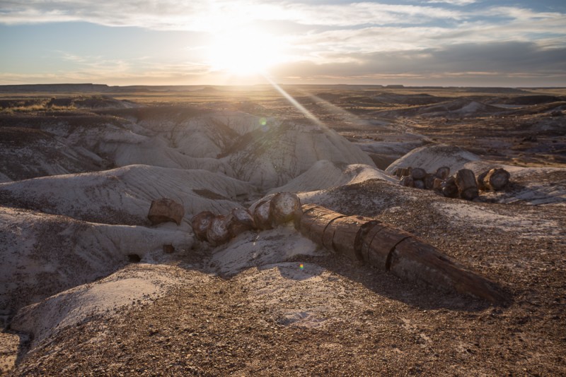
This is where I was first able to see the petrified wood of the national park up close.  Little pieces were littered across the flat areas, as if the trunks had rolled down the hills and shattered.  It’s interesting to think about the unique circumstances that cause wood to become petrified.  There had to have been a forest here so many years ago.  It’s hard enough to imagine the area covered in a dense forest.  Then the area needs to be covered with silt and volcanic ash and cut off from oxygen by some large-scale event.  Then groundwater would seep in to allow the silica to diffuse into the wood.  And then, through lifetimes of erosion, the logs are finally revealed.

IMG_2884m

It was getting to the late afternoon as we continued along the drive.  The Agate Bridge (not pictured) is a well preserved log that formed a bridge across a small ravine.  In 1911, supports were added underneath to prevent it from falling apart.  The National Park Service has adopted a different philosophy now; today, the bridge would be allowed to continue to crumble and left in its natural state.

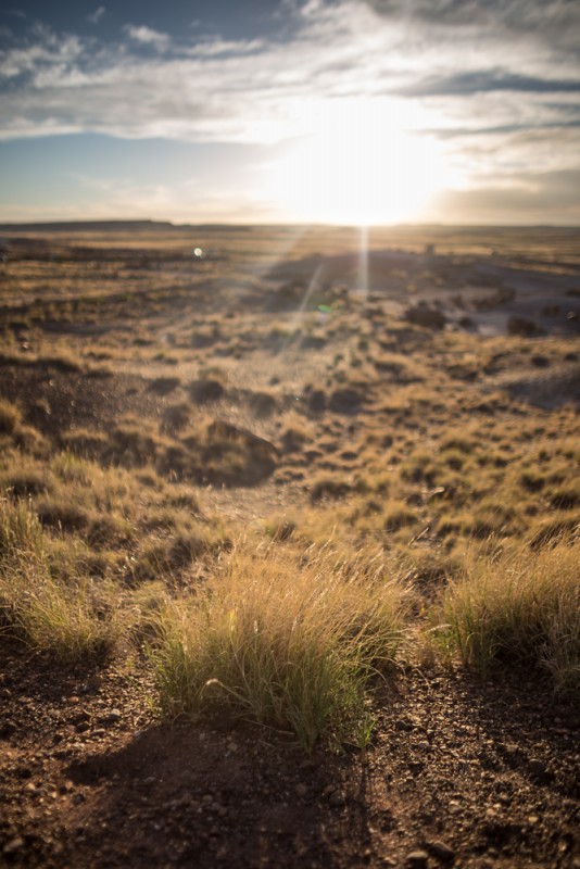
As we headed further south, we ventured into areas of the park that had bigger and bigger logs.  We walked a loop through the Crystal Forest and enjoyed a silty-white landscape littered with logs and an expansive sky that was deep blue and orange because of the setting sun.  I feel the need to reiterate how profoundly beautiful this experience was.  The air was still warm, there was a strong breeze flowing, the sun was low in the sky and getting lower.  The ground was white and littered with petrified logs and chunks thereof.  You could see for miles and miles in each direction.  And there was nobody else around other than my Dad and I.

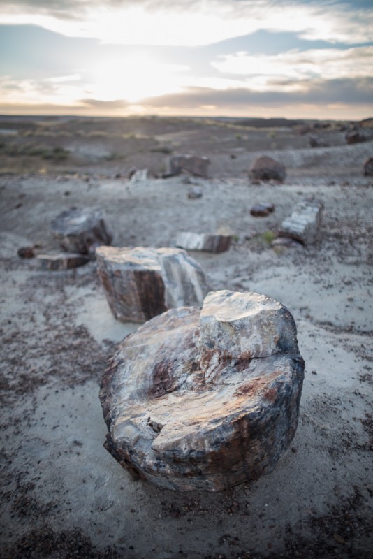
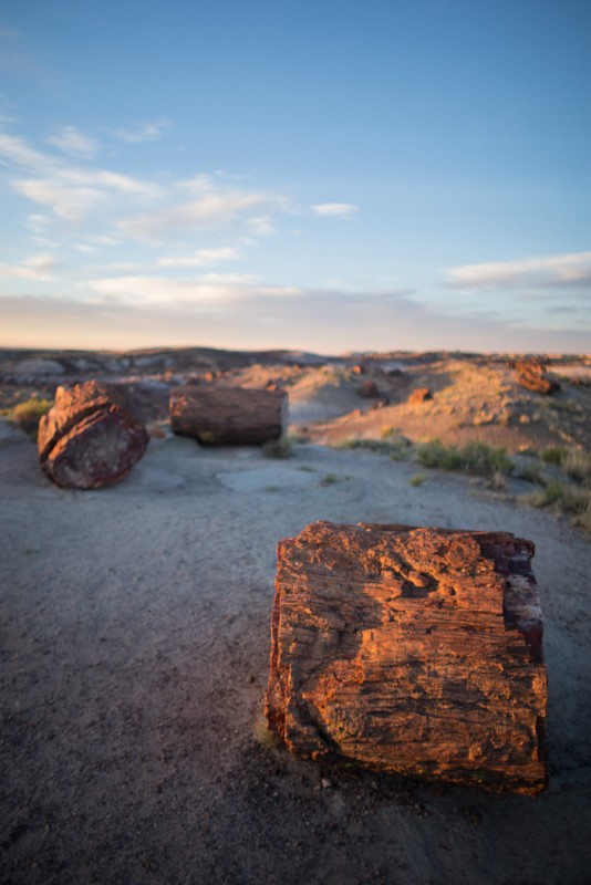
Walking along the loop, we could get a close-up look at the petrified logs.

IMG_2909m

As the sun set further, the whitish logs became a deep golden color.

IMG_2935m

IMG_2933m

This scene was particularly beautiful and amusing to me.  It reminded me of those idyllic scenes with a tractor and hay bales – except the bales in this case were petrified logs weighing hundreds of pounds.

IMG_2942m

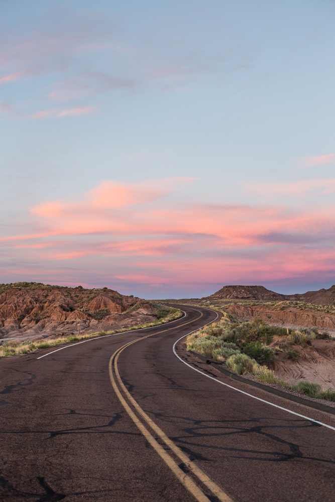
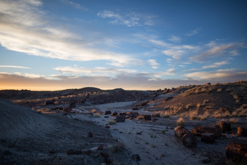
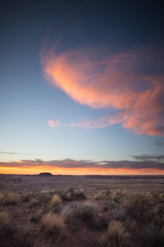
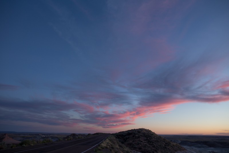
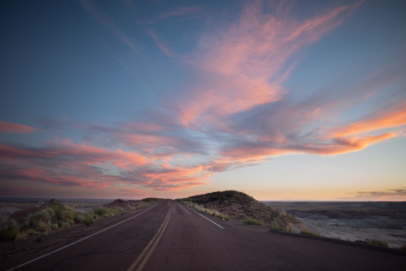
Somehow, impossibly, the scenes continued to get better.  The sun continued to set, and the sky lit up with pink, wispy clouds, and the landscape lost its long, harsh shadows.

IMG_2958m

We pulled over to the side of the road where two other cars and groups of people stood to catch the sunset.  We watched this one cloud hover and change for a long time.

IMG_2968m

IMG_2978m

IMG_2971m

On the way out of the park, we passed by a few touristy gift shops that were selling petrified wood.  They were closed due to the time of the day.

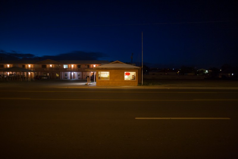
We got dinner at a steakhouse in Holbrook, Arizona.  When’s the last time I ate from a salad bar like this?

IMG_2996m

After dinner, we headed west on 40 to our next destination: Flagstaff.

IMG_2991m

Visiting Monument Valley, Arizona/Utah

monument valley

We stopped through Kayenta, Arizona, to refuel on our way up to Monument Valley.  We got gasoline at a gravely station and we used the bathroom at a hotel.

kayenta az

kayenta az

And stopped into the grocery store, Bashas’, to get some snacks for the road.  Somehow, we ended up talking to a woman in line for a long time – I had written a note to self, a year and a half ago, when I was drafting this blog post, to write about that little anecdote.  But now, too much time has passed and I just don’t remember.  I recall speaking to her for a while near the checkout.  She lived fairly far away but this was the closest supermarket.  There were some family issues that I cannot remember.  Something about her husband who had a work-related disability?


I do still remember pondering her situation of living so far away from a grocery store.  It was a 45 minute, maybe an hour drive?  And it was the type of store with their own store-brand Bashas’ soda machine outside and walls made of identical cans of Golden Sweet Whole Kernel Corn.  What a different way of life compared to our complaint-worthy 15-minute walk from the nearest grocery store here.

Once on the road again to Monument valley, we stopped by a little dreamcatcher stand on the side of highway 163.  It was hot, and dreamcatchers shifted in the breeze.  Other little items of jewelry rested on the table.

dreamcatchers

It was a quiet stand. The whole time we were there, only two other people stopped by.  There were other cars in the lot, but they appeared to below to the people who staffed the stands.  I wonder how many people stop by over the course of a day?

The turn onto Monument Valley is pretty easy to spot.  Just a right turn off of 163.  We parked in the parking lot of The View hotel, looked through the gift shop/trading post.  I peeked my head into the restaurant.  There’s a lot of nice seating outside of the restaurant and a large viewing area.  The hotel rooms looked like they suited they suited the hotel’s namesake.  What a sight to look out to.

monument valley

We wanted to get a move on and drive the Monument Valley loop before the sun went down, so we decided to come back and check out the rest of the hotel later.

It’s a pretty mellow drive.  Some parts are quite sandy, so be aware of that.  Our car nearly got stuck a few times, and then actually did get stuck about 2/3 of the way through the loop.  After a few minutes of amusement that turned to minor panic, a group of people who were stuck behind us helped give our car enough of a push to help us get out.

But before that, there are plenty of mesas and sand to look at.  The main driving loop surrounds Rain God Mesa, and there are a number of points on the map where you can stop.  We stopped at all of them.  One stop had a pink food truck:

monument valley

That stop was probably John Ford’s Point.  Also there is a cowboy and a horse stationed for a photo-op.  It looked hot and uncomfortable to spend much time out there in full garb.  But it does make for quite a scene.

It was great driving around the mesas and buttes, but honestly, I think the best view is from the hotel.  I think the North Window Overlook was my favorite part of the loop.

We returned to the hotel, and sat outside in the shade to watch the sun set.

I noticed this carved into the wall of the viewing area.  I don’t know what it means.  But I can see the attempted “translation”: “I like Chow Miene”.  I don’t think that is what it says.


monument valley

While we watched the sunset, we ate our snacks and ate some dinner from the restaurant.  The combination of wide open space and tall rock formations makes for looooooooooooooooong shadows.

monument valley

It was incredibly peaceful to watch the mittens despite being surrounded by a number of other people.  Some were chatting with one another, there were a fair number of kids, and there were also a bunch of photographers, with and without tripods, taking photos of the unfolding sunset.  Some kids even had brought a football to toss around.

monument valley monument valley monument valley

It was such a profoundly peaceful and beautiful place.  It felt uncomfortable to be there in the harsh afternoon heat and direct sun, but at the same time, you could look around and be in awe of the vast expanse surrounding you.  I had hyped it up to myself a lot, and it was a strange combination of being underwhelming (I had wished for more clouds?) and more beautiful than I expected all at once.


Our experience at Lower Antelope Canyon, in Page, Arizona with Ken’s Tours

lower antelope canyon page arizona

lower antelope canyon page arizona

When you start looking up information about visiting Antelope Canyon , one of the first things that you will discover is there is an Upper and Lower portion of the slot canyon.  This post contains photos from my trip with a guided tour from Ken’s Tours that I experienced with my dad.

Researching Antelope Canyon was kind of funny to me, because I thought to myself, “wow, this place really exists!”  Funny because it seemed to be a mystical place not from this planet.   And not only that, but there are two separate Antelope Canyons?!

I think I must have seen a photo a number of years back of a narrow canyon with smooth yet gnarled, orange and purple striated sandstone walls that ended in abrupt jagged corners and a beam of volumetric light from above illuminating a small space on the ground.  It looked like such a special place.  I think a while later, my friend Sarah shared a photo of her visit to Antelope Canyon, and I realized, “wow!  people actually go there!  I want to do it too!”

Upper or Lower Antelope Canyon?

I started researching Upper Antelope Canyon vs Lower Antelope Canyon (Hazdistazí in Navajo) and learned that apparently Upper Antelope Canyon gets way too crowded.. and so does Lower Antelope Canyon.  But less so.  I also learned that if you pay more and bring a tripod with you (strange requirement, but sort of understandable since it’s a bit darker down there and it helps to stop down to capture all of that amazing detail) you can go on a self-guided tour of Lower Antelope Canyon – but the same isn’t possible for the Upper canyon.  I still wanted to see the Upper canyon, though, because that one beam of light that I saw in that one photo was taken in the Upper section.  I did more research and found that thankfully, there are light beams that come through Lower Antelope Canyon as well.  So, I decided to try the Lower canyon.

Do you need reservations?

Next came the question – do you book in advance?  Or just show up?  I didn’t want to get all the way to Page and not be able to see the slot canyon.  The website for Ken’s Lower Antelope Canyon tours tells you to just show up.  So that’s what we decided to try, though I was worried that it’d be hard to get a spot on a tour if I had nothing booked in advance.

Lower Antelope Canyon was a very short drive from our hotel in Page.  Heading East out of Page on Highway 98, you turn left at Antelope Point Rd, which is the first left if you’ve taken Coppermine road out of town.  If pass the power plant/Navajo Generating Station, you’ve gone too far.

Which tour company?

As of our visit in June 2014, there were two tour companies that had set up shop – Lower Antelope Canyon Tours and Ken’s Lower Antelope Canyon tours.  I think the price was the same at both places.  I was informed that the Lower Antelope Canyon Tours folks were operating without a proper permit from Navajo Parks, so we went with Ken’s tours.

We didn’t have to worry about making a reservation.  We waited about 15 minutes for a tour to start, and the followed our guide Brian into the canyon.  I had read about the tour groups being crowded when doing research before the trip.  Our group had about 12-15 people, which felt like an okay size.  It would have been great if there were less people, but people were patient and waited for each other to take photographs.  Brian was also very helpful in managing the group.

Before you even descend into the canyon, you can see the layers of sandstone in the rocks that lead the way.  Foreshadowing.  The canyon isn’t obvious – from about 20 feet away, you can’t even tell that it is there.

lower antelope canyon page arizona

There are steel ladders leading down into the canyon.  Past ladders had been swept away by flash floods – eleven tourists were killed in 1997 when a flash flood hit.  In 2010, tourists were stranded for hours when another flash flood hit.  Brian explained that these days, they get a radio message from Navajo Parks if a storm is expected.  It’s amazing to think about the amount of force that such a huge rush of water can exert – but it’s the same type of forces that carved the canyon into the stone in the first place.

lower antelope canyon page arizona

If you’re wondering how strenuous Lower Antelope Canyon is, it’s not too bad.  There is some climbing up and down ladders.  If you can handle that, you should be okay.  There are also some areas where there is not much head clearance.  I did bump my head lightly against some sandstone.

lower antelope canyon page arizona

I admit, I started to get pretty giddy after we had descended the ladders.  “Wow, it’s so crazy that this is real.”  The rocks really do have amazing purple, red, and orange hues.

lower antelope canyon page arizona

There are pits in many of the otherwise smooth sandstone walls – this is due to rock impacts during flash floods.  There are small bumps  on some of the walls also, caused by limestone deposits over the course of time.

lower antelope canyon page arizona

The canyon is not too deep.  It’s maybe 50 feet from the surface at its deepest.  In most places, you can look up and still see part of the sky.  It felt nice and cool inside.

lower antelope canyon page arizona

Brian was a nice tour guide.  He stopped briefly at many points to show us various features in the canyon – a profile of a lion’s head, a woman’s face, a fish, and other interesting shapes.  He offered to take everyone’s photos at a number of interesting points along the way – and made sure to set everyone’s iPhones on the “chrome” filter setting to make the colors pop.  He had some general pointers for SLR users also, though they were mostly targeted towards the crowd who leave theirs set on auto.  He said he didn’t have any photography experience before leading these tours when I asked.  He seemed to have picked things up pretty quickly in his three months of experience.

lower antelope canyon page arizona

The walls look like pointy rainbow sherbet!

Photography tips

If you are curious what the lighting is like in there, I took most of my photos on manual mode with auto ISO.  I had the shutter mostly at 1/60 and aperture set anywhere from f/4 to f/13.  I tried some wide open just to see what the photos looked like, and I was disappointed.  All of the detail in the many layers of sandstone is worth stopping down to capture.   A tripod would definitely help, but you have to pay extra to bring one down.  I think this is due to space constraints.  (Oddly, as I mentioned in the beginning of this post, to qualify as a “photographer”, you need to have a tripod and put down $50 for a special permit.  This allows you two hours in the canyon without a guide where you can explore on your own.  Not too bad of a deal, but I wanted to be able to experience the canyon with my Dad, and I wasn’t sure if they’d let him accompany me.)  In the photo above, here were the settings: 24mm f/11 1/60s ISO12800.  Crazy high ISO and you can’t really see any noise.  The Canon 6D is nuts.  Even at full resolution, the photo doesn’t look too bad.

Lenses:

I brought my 50mm and 24mm lens into the canyon with me.  I used the 24mm for 80% of the shots.

lower antelope canyon page arizona

I think that Brian said that each line in the standstone represents about 1000 years.

lower antelope canyon page arizona

There’s one light beam that comes into Lower Antelope Canyon.  In June, when we went, the sun shines through around 11am.

lower antelope canyon page arizona

Brian threw some fine sand up in the air to make the effect of the light beam more dramatic.  I asked him about the sand in the canyon – he said that in some places, there is a foot of sand between our feet and the rocks below.  When flash flooding occurs, the sand is all washed away by the water.  People dump sand back in to make it easier for us to walk through.

lower antelope canyon page arizona

Here’s what the canyon really looked like most of the time.  Though there were a decent number of people in our group, we all took turns when we got to special areas that would have looked better empty.  I remember there being a few people from Singapore, a couple from Italy, some Americans, and a few others.

The tour lasted about an hour.  The ladder out of Lower Antelope canyon was much shorter than the one we descended on the way in.  There are a few dinosaur tracks on the surface that Brian showed us on our walk back to the ticketing building.  We thanked Brian, said “ciao” to the Italians, and were then on our way to Monument Valley.


Horseshoe Bend, Page Arizona

horseshoe bend, page arizona

horseshoe bend, page arizona

Horseshoe bend felt like magic.


I don’t know how else to describe it.  It’s not an isolated spot, but the fifty or more other people there who are also admiring the view don’t take away from the magic.


But where is Horseshoe Bend?  It’s at the Northern tip of Arizona, just south of Lake Powell.  The nearest city is Page, which is only 4 miles away.  It was created by the Colorado river and the cliffs are about 1000 feet above the water level.  It’s a 10 minute drive from Antelope Canyon, so I’d definitely recommend seeing both of them if you’re in the area.

We approached from the west and stopped for a minute at Glen Canyon Dam to enjoy the orange cliffs and reaffirm my fear of heights.  From there, it’s just 5 or 6 miles down Highway 89, slightly past Page.


There’s a parking area off of the highway, and then a 20 minute walk up and then back down to the cliff’s edge through some fine red sand.

horseshoe bend, page arizonaThere was a stream of people headed in both directions.  Many of the folks that were headed to the overlook had the same plan of catching the sunset over the bend.

horseshoe bend, page arizonaThe overlook was windy and sandy.  When the breeze picked up, I could feel little bits of sand pelting my face and skin.  It made me think of what millions of years of this light sandblasting does to stone.

Once you look over the edge, it’s amazing.

horseshoe bend, page arizona

Many folks had their phones or cameras out, but others were content to just sit and enjoy the view.  Some photographers had tripods set up.  One group of people were even taking a series of photos with different outfits and model poses.

Though there were a decent number of people around, there were plenty of places where you could squeeze in and peer over the edge.   It is kind of scary.  I was surprised to learn that only one person has died falling off of the cliff in the last 20 years or so.

horseshoe bend, page arizona

By the time the sun went down, the crowd had thinned out a bit.  We hung around and watched the sky and the bend for another 15 minutes, then walked back to the car.

horseshoe bend, page arizona

You could see the lights of Page in the distance.

horseshoe bend, page arizona